Coco the wonder runt cattle dog
Overview
Our usual pattern for vacations was to head up 395 and camp somewhere close to the Eastern Sierra. In past few years the summer season has been very crowded and we wanted to find some new places in our 20 foot RV, keep social distancing, and use secondary roads for less stress while driving.
We became adoptive parents of CoCo, wonder runt cattle dog at just about the start of the virus lock down. She made the stay at home mandate easier to take and we began a mutual attachment relationship amid the boredom of the groundhog day repetition that all of us have learned to live with. When her shots were up to date and immunity intact, we were anxious for a road trip. Usually we go to Baja Sur, but their virus problems and the new dog put the nix on that destination.
We decided to see America first, even though the virus was peaking in a few of our favorite states. The plan would involve visiting Kathy's parents in Kingman, Arizona, heading north of Flagstaff to the Sunset Crater National Monument, on through Navajo country to just north of Page, Arizona to Lone Rock at Lake Powell, through Utah to Cedar Breaks National Park and then to Lincoln County in Nevada. We made no reservations and would be using our 20 year old Wilderness 20 foot RV, which has less than 50K miles on the odometer. After Lincoln County the details were more vague, with a possible link to the Eastern Sierra from highway 6, out of Ely, Nevada.
First Day
Kathy's parents moved from San Diego to Kingman about 25 years ago for the excellent hunting and fishing in the vicinity. It had been many months since we last visited because of the virus. We backed the RV onto their large cement slab, which provided a nice blend of closeness and our own space. Kathy was concerned about social distancing so we agreed to visit outside on their patio. It was a beautiful late afternoon when we arrived and caught up on all the recent family news without getting into any pesky political topics. We ate separately and talked well into the night. The next morning we said our goodbyes over coffee and hit the road.
Kathy's mother Nancy "Nanny" and Clyde
Second and Third Day
It had been near 100 degrees in the desert the day before, so we were glad to experience the high mountain rolling hills leading to Flagstaff on highway 40. Being used to the 395 congestion provided quite a contrast to the miles and miles of juniper groves and broad expanses of valleys with golden acres of flat grazing area without many bovines or signs of human activity.
It was paradise lost as we attempted to take 89 north through Flagstaff. The town has grown exponentially and let us just say that development planning was not a strong suit for the city fathers of this fair city. There was some snow left on the higher peaks and we were hopeful that our Monday morning arrival would give us some luck in finding a place in the campground just at the entrance to the Sunset Crater National Monument. Lucky campsite 9 became our new abode and the Golden Age Pass got us a $13 rate. Decided to pay for two nights and slow down the pace of time's passing.
View of campsite 9 from our screen door
I would rate this campground at near 5 star. Pleasant hosts, clean restrooms with a big jug of hand sanitizer out front, spacious and well spaced campsites that insure social distancing. The mostly Arizona campers were friendly without being too nosy, kept control of their dogs and kept any domestic disputes indoors. For most of our stay, the weather was cool with wind that was quite strong in the pine forest. The floor around the monument was between pumice, volcanic pebbles and fine black dust.
Coco's first hike
The next morning we took our first hike with Coco along a trail that went to the crater parking lot, about 1.5 miles. The hiking was a bit more difficult than hiking on soft sand. It ended at a fenced sign reading "no dogs". It was a beautiful hike with moss on the volcanic boulders and shady from the pines. The hiking surface I would rate as less than two stars. There were no trails like the ones in San Diego or the Sierras. The next morning we rose early and headed for Navajo country to the north.
Fourth Day
The lower altitude portions of the Navajo country are much as Tony Hillerman describes it, with poor vegetation only suitable for goat herders. The homes are a montage of trailers, traditional hogans, non traditional hogans with rectangular additions, and cars in various states of functionality. The road has numerous rough structures at any wide point, where Navajo jewelry is sold. As the elevation increases, there is not only the eye popping beauty of the marbled red rock but also enough vegetation to have cattle and horses wandering around in bucolic splendor. The rez has been hard hit by the virus and the FM radio stations give the numbers on the various tribal areas. It does not sound good.
As we get to Page, Kathy goes into the Safeway for some potatoes and wine. She reported that all the employees were native american and that they were doing the good social distance and masking. The tourists not so much. While she was gone, a middle aged, handsome man approached the RV. He appeared Navajo and did not look intoxicated in any way. I told him that I was paranoid of the virus and didn't want contact. He had kind eyes, looked intelligent and gracefully acceded to my request. In retrospect I wish that my solution would have been quicker and just gave a few bucks out of the window crack at the top. Oh well, will get it right next time or in another life.
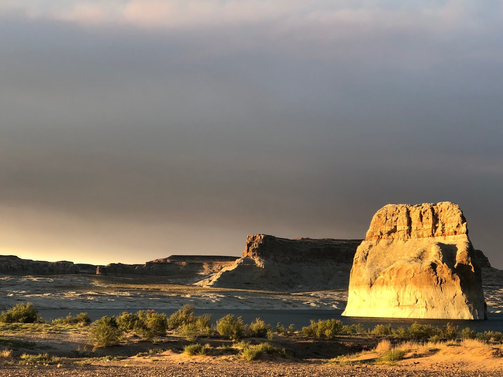
Lone Rock and the shore of Lake Powell
We get to the turn off for the Lone Rock state park and are impressed with the view of Lake Powell.We passed the Glen Canyon Dam just prior to the turnoff. It was hard not to think of Edward Abbey's books on the destruction of Glen Canyon that was necessary to create Lake Powell. The lake is quite shallow so the evaporation water loss is considerable. Also, the cultural artifacts and rock art of Glenn Canyon were forever lost by this flooding. The water's edge is filled with RVs, tents, cars and people. It is about 95 degrees, so it all looks inviting, even if not politically correct.
From the pavement, there are 10 or 15 possible dirt/sand access roads. I pick one that looks pretty good and keep up the momentum through the sandy parts. Once I let off on the gas briefly and could feel the vehicle sinking fast. Gassed it again and got through. I had read some reviews about people getting stuck, but surely that wouldn't happen to me. By the time we found a high camping spot away from the crowd, Kathy was thinking we should try to get out. My take was that it was the middle of the day and if we were to get stuck, the 90 plus degree heat could cook my 76 year old corporal container.
Instead, we decided to hike all the sandy trails and decide on the best one for tomorrow morning. Kathy hiked in flip flops but after three decades of marriage I have learned at least part of the time to keep my mouth shut. After about a 45 minute extreme exercise component, we decided that there were no slam dunk exits, though some were certainly worse than others.The rest of the day was spent drowning our troubles and watching people get stuck going downhill, uphill and sideways. The most comical was a Prius potential grand prix racer, who detached his rear bumper except for a few bolts that allowed him to drag the bumper until he almost reached the water.
The sky and sun took an eerie glow from the dust and smoke
I talked to our neighbors, who looked like they might know what they were doing, about the best exit road. We walked that one before nightfall and decided to call it a day. By this time the smoke from the North Rim fire was pretty thick and the dust had begun to blow in earnest. At that point, the fire had consumed 85,000 acres. We went to bed and Kathy reported in the morning that she had been too anxious to sleep.
Day Five
At daybreak, I warmed up the engine, took it out of overdrive and into 2nd gear. We got a good running start on the first sand section and began getting thrown from one side to the other while bouncing on the woop dee dos. It was very exciting and I was hoping that the vehicle wouldn't break somewhere. The second bad section was almost to the road and the speed kept us on top of the sand well enough. We were very happy to bid Lone Rock goodbye and celebrated by dumping the bad stuff and taking on some cool, clear water.
We continued on 98 up into Utah, turning back toward Cedar City on 14. Cedar Breaks National Monument was our destination. We called about campsites, but the virus made it almost impossible to get a current status. We passed through some of the most beautiful, lush farmland and tourist services in the narrow valley from Mt. Carmel northward to 14. As we gained altitude from the turnoff, the landscape became dominated by lava flows with intermittent large grassy meadows. As we got to Cedar Breaks, the high altitude provided cool breezes. At the park entrance, Kathy noted that Coco had a slight limp. At Lone Rock I remembered her yelping at some point. Bad omen. Equally bad was the fact that the campground was still closed, with some snow patches.
Descended through Cedar City and out toward 56 westward toward Cathedral Gorge. Flat grassland meadows with depressing looking residences and trailers at about 4000 ft elevation. At the the Cathedral Gorge campground in Lincoln County we found a small, claustrophobic setup where every other camp was closed off with wooden poles. No room at the inn.
BLM campsite well south of Ely, Nevada
note the metal, high shade and cement table
Beautiful views to the east
Continued on 93 to a BLM ohv camp on a dirt road. We were overjoyed to see an excellent trail head setup with two sites that fit our needs. It was a no fee campground. There were three other rigs, but everyone was quiet and it had beautiful views. When Coco got out of the RV, her foot had gotten worse and she was putting no weight on it. I spent a beautiful hour doing yoga on the concrete dining table while Kathy and Coco called it a day. The next day we agreed to head for home to make things easier on Coco, taking a shortcut to 15, through Las Vegas and more or less retracing our route home on 95. We stopped at Palo Verde, but the 102 degree temperature was daunting, so finished the trip off with a 12 hour day to highway 8 and home, safe and sound. The vet bill the next day was $500, but Coco is doing much better after four days at home. The trip was a great change from being stuck at home for three months!
Lessons Learned
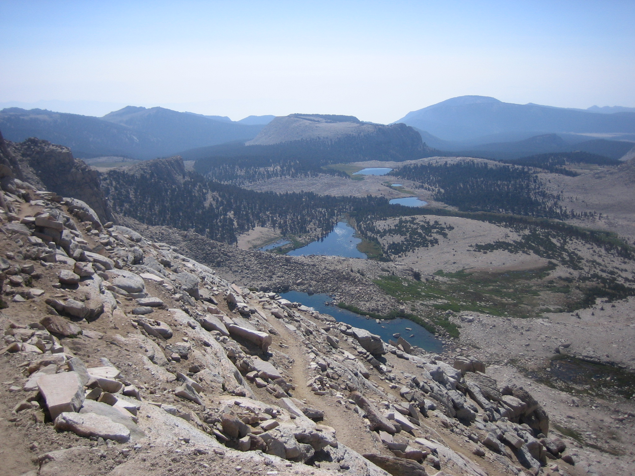
The use of secondary roads made the driving much easier and for the most part the traffic was quite light. In the future, would return to Lincoln County (south of Ely) via a more direct route through Las Vegas. The area north of Flagstaff is nice, but the hiking is quite limited. Lake Powell and Cedar Breaks were not places of solitude and the latter is probably better served in the winter on cross country skis, which we have done many times out of Brianhead. We liked the area south of Ely and it looks like a good summer destination because of the generally high altitude, which keeps it cool in the shade and warm in the sun. Oh yeah, I have decided not to wear my size 13 shoes in the motor home, to safeguard Coco's little toes.