Saturday, November 21, 2015

The Ghosts of Bow Willow in the Anza Borrego

(click on picture to enlarge, click on x in top right to return)
                                                     
Bow Willow campground is located about 15 miles from Ocotillo on Highway 2. The turnoff toward the west is just past the Carrizo Wash. We have been going there since the early 90's. My grandfather had a place in Ocotillo in the 50's and I went there frequently to hike and shoot .22 rifles at beer cans and other assorted targets. My grandfather and I would eat at the Miller's Cafe and go to the Miller's garage for men talk. Here is what the Miller Garage looks like now:


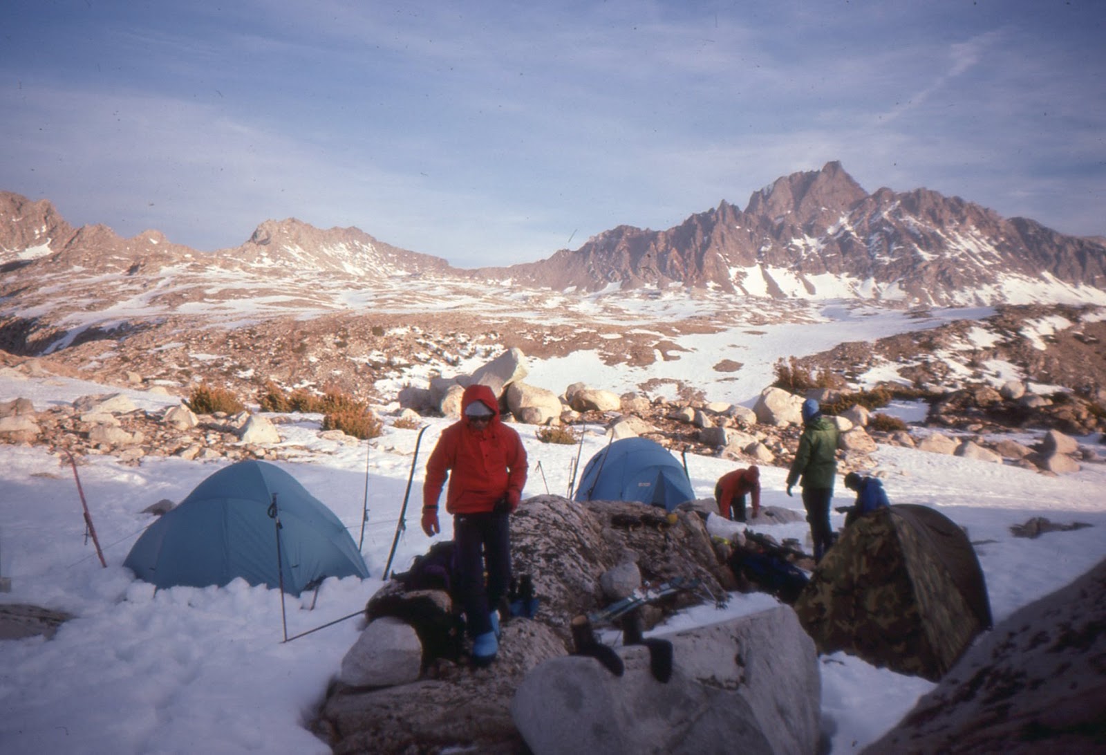
Since Ocotillo is not in the Anza Borrego State Park, it has become a focus of the alternative energy plan of SDG & E. My grandfather probably would have considered this catastrophic. The native Americans who endured the white guy migration probably would have gone along with this assessment. OK, Miller is one ghost down.

The next ghost is the ghost of the "gol danged" Indians. If we are talking about a percentage blood type to get a good monthly stipend, we are not on the same page. "All the Wild and Lonely Places" is kind of my go to book on the Anza Borrego, its people and  history.

 I am seeing big holes in rock made by these people. This did not happen overnight!


This is seventy feet from our campsite. There were at least 14000 people here when the newcomers came and started their deal at about 1830. At the turn of the century, there were about 1,000 left. Assimilation means you are the losers. Good luck to the casinos to get some of it back.

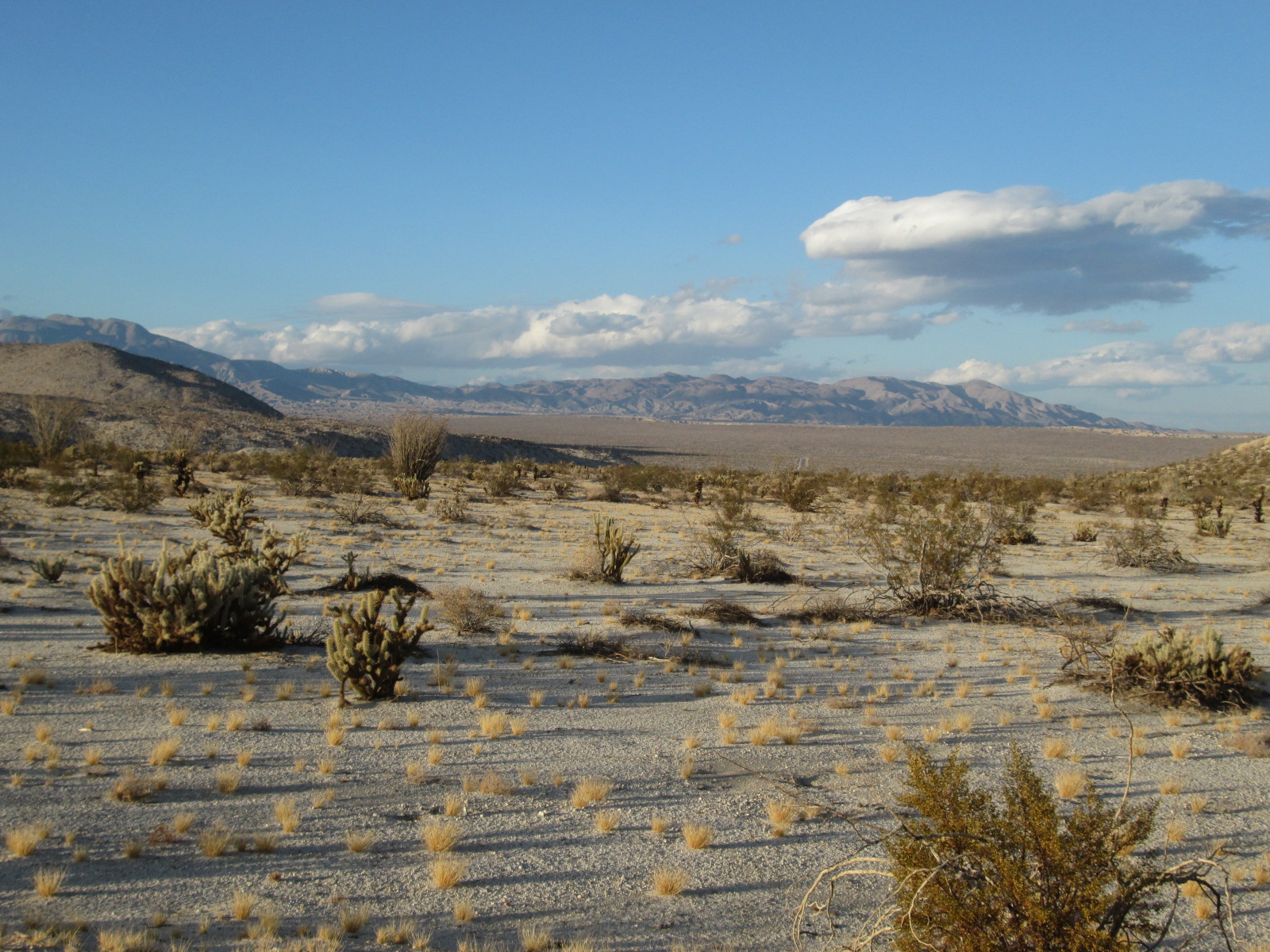
If the truth be known, many times truth is in the heart of the beholder.The indigenous tribes  knew water sources could become dry and lakes disappear... .In 1992 and 1993, water filled the Bow Willow Creek!


This is maybe a quarter mile from the campsite. Water is everywhere.

Things change. If you are a local in the 1800's, things are changing very fast. Your people are getting sick from weird diseases. The whites are grabbing the good hunting land to feed their cows.Your  bows look weak in comparison to a repeater. God, this is not fun and the outcome looks pretty certain.

So, we are having a fun vacation and the ghosts are upon us. Kathy remembers Alli with us at Bow Willow in the early 90's. I remember my grandfather at Ocotillo, telling me that we are lucky to experience this. We both remember the shared times with our friends in times past. Who doesn't remember something about the past that is associated with a place that we revisit?

So, here I am.I'm thinking about my grandfather, who did all deals on a handshake. I haven't done many deals lately with a handshake.

So, Kathy and I are still thinking about our friends and family at this place we have been for 20 plus years. Somehow it is not the same with just us. Do we require the quietude that surrounds us every moment?

Do we learn from the quiet that has been created through the white man's rediscovery of a place that wasn't a "wild and lonely" place in the past?

Chief Francisco Patencio says:
" All the wild and lonely places, the mountain springs
  are called now. They were not lonely or wild places in
  the past days - no. They were the homes of my people,
  who lived contented and happy. Sometimes an Indian
  goes back into the mountains to a spring of water.
  There
  he visits, alone the home of his ancestors."

Hogue in AWLP  cites:  "When the time comes" they (the Cahuilla) would say, meaning that catastrophe could strike at any moment. We look at the difference between 1992 and now in Bow Willow Creek. Now the creek is dry. 20 years ago, it was a paradise.


So, as you may have guessed, my deal is the nature of change. Your mother dies, it is a terrible thing. My mother dies and it is a catastrophe. The closer to home the more the tragedy. My problem is that the tragedy was for the native american people, not the inclusive us.

The native american lived closer to the land and understood that big change was just around the corner.  A careful observer of the desert sees overuse of ancient water vaults. The book "Cadillac Desert" documents some of our arrogance toward this precious resource. What will the future hold for us that have been here a few hundred years? Sometimes science fiction isn't about space ships and alien beings. The book "The Water Knife" (by Paolo Bacigalupi) instead uses the theory of "Cadillac Desert" and paints a picture of states and power barons fighting over the water rights to the Colorado river. Phoenix and other cities become losers in the water struggle. The inhabitants are thirsty and subject to the rule of gangs and thugs. It isn't a pretty picture.


This is looking up Carrizo Gorge from Egg Mountain. To taste it's secrets, carry plenty of water and hope for a breeze. Bring a stick to scare off the snakes! At the top is the giant wood trestle.

So we are going to do Canyon Sin Nombre on mountain bikes tomorrow. Love the adventure of this ride and the fact that Kathy is going to do it with me.


The route is quite simple and here are instructions and a map to help you do it. Take the dirt road from the campground and go back to s22. Turn right on the pavement and proceed up Sweeney Pass. Close to the scenic overlook of the badlands, drop down Canyon Sin Nombre at the above sign. Enjoy the passage through the canyon and it's story of geologic time. When you are through the canyon, turn left at the first junction and head west toward Sombrero Peak, using Carrizo Creek wash. You will pass a Tamarisk grove (called "the trees") just before making it back to S22. Go north and they retrace you downhill ride towards the campground.


On a mountain bike, downhill in soft sand is really fun. Keep the speed up to stay on top and just point it. Going up hill, not so much. The good part is going up to the top of the hill on a paved road, then hitting the overlook and giving a hoot all the way down to the trail that hooks back up north towards the west.


Toward the top and with Sombrero Peak towards the right (west) side.


After reaching the bottom of the canyon, take a left and head back toward Sombrero Peak (west). It is a mild uphill filled with creosote bushes and their colonies. One such colony in the Mohave is estimated at over 10,000 years old. The desert people used these bushes to help cure 14 different conditions.

We arrived back at the campground, a 15 mile loop. Fortunately, it was 5 o'clock somewhere and we celebrated our good fortune with a nice glass of wine.


If you have Google Earth installed and want to take a virtual tour of the bike ride: Click on the link below to download the kml file of the ride. A map will come up with the menu on the left top side. Select "File" and then "download". The kml file will be in your downloads folder. Click on the kml file and you will activate Google Earth and can get a bird's eye view of our route.
Click here to download kml file

Saturday, November 7, 2015

Late October 2015 Hikes and Camping in the Eastside Sierra and Death Valley

                                                           
                            (click on pictures to expand)

We bought a small Carson trailer called the Kalispell. It's main claim to fame is that it held the land trailer speed record at 141.998 for a while ( Kalispell land towed record attempt ). It is tiny with an 11 foot box, but easy to tow and just right for Sierra day hiking base camp. In late October we set off for an 11 day adventure.

 Due to family obligations, the timing of the adventure was a little past the optimum fall schedule. We left San Diego about 9 AM and had an easy drive to 395 and on to Tuttle Creek BLM campground, just out of Lone Pine. Our original objective was to drive up to Horseshoe Meadows without the trailer and check out he Cottonwood Lakes, to find a good campsite to stage for Mt. Langley, a 14,000 ft mountain over Old Army Pass.

We picked the top site on the South side of the creek, a part of the campground that was closing in a few days. It was practically deserted, with a clean pit toilet close by and the nice murmur of the creek for good sleeping. The weather was threatening and the chances for Cottonwood Lakes for tomorrow looked slim.


Our plan B for the next day was a hike up the North side of Tuttle Creek toward the West. It was basically a 6 mile bushwack, which would allow us to get back to camp if it started to rain. Like most BLM land, it is multi-use and the cattle have had their way with it. Still pretty nice hiking and we were tired by the end of it. The views were good from up canyon, across the valley toward the end of the White Mountains.


Had a nice experience of both alpenglow and the moon as we enjoyed our last night at Tuttle Creek.


Since the access road to Horseshoe closed the next day, we prepared to head to the Pleasant Valley BLM campground, just North of Bishop. Kathy noticed the junction box from the truck to the trailer was smoking, so I disconnected our plug to the truck. Now we were driving with no trailer lights or brakes. 395 is a series of small towns with nice people, but it is not the technology nexus that characterizes SoCal. We headed for the big town of Bishop and tried a few places. The look on the faces when I described the situation did not endear much confidence until we went to Auto Tech, behind NAPA parts. He had us on our way in an hour, once he got to it.

Life is good, we are on our way again! The BLM campground is aptly named the Pleasant Valley Pit Campground. It looks like they were mining for something and then quit. It's saving grace is that the camping fee is $2 and there are 4 pit toilets. It is a hangout for dirt bag climbers and other riff raff and hangers on. It brings a variant on the light bulb joke. How many climbers does it take to fill a campsite?


Because of our age and lack of sound equipment, we chose to camp on the rim of the pit, overlooking the Mad Max type montage at our feet. We packed our packs, drank some wine and anticipated the jewel of our trip, the hike up from North Lake to Piute Pass and maybe beyond to Desolation Lake. It was really quite quiet and we were exhausted from running around and worrying about car crap.

Our next morning burned bright and cold. We took the Ed Powers Rd. back way to North Lake while enjoying the burst of  fall color from the Aspens hitting the right elevation. At the trail head, more cars than expected. A couple were taking  a horse and two mules out of their trailer and feeding them. We waved, not much return.

It was cold at the onset and once again am wondering if still have what it takes to take 32 degrees. My hands hurt and barely keeping up with Kathy on the way up the first part from North Lake. It is steeper at the start and the creek makes the freezing temps feel colder. Finally, about 25 minutes out, the warmth of moving had it's way and no more hand pain. Kathy takes off the down vest she has borrowed and we get down to hiking, our strong suite. Ice is everywhere and the trail is full of water. Mostly we are just using the trail as a guide.


The aspens at altitude are truely going off. The color is never captured totally in a picture. The leaves flutter and they are making way for the bareness of winter. We are now moving without hesitation and with expectation to make the pass and maybe more. We reach the first hunter before the horse people catch us. All the hunters we saw were at the prime of their deal. Mid thirty's or older, strong and I think Kathy found handsome. Kathy and I ruminated about how they would get a deer down after terminating it's lifespan. Kathy is more at ease with these kind of questions, so I just played dumb (very easy).

The second guy we encountered looked beat. I do snow camping and would guess his pack at 55#/60# without a dead deer. Kathy asked him, " how do you get the deer to the trailhead? He patiently explained that the deer must be male to do the required procedure. First, you must take the horns. Then, eliminate the fur and bones. Take the remaining 80# or so of meat into your winter pack, tent and sleeping bag, plus food , water and stove. Maybe make two trips! Wow! These guys are tough.

Finally, the final question. We have not seen shit for deer. Where do you expect to find them? Our oracle from Big Pine was named Tom. He had a beautiful bow, no pulleys, and a quiver full of arrows that I would stake my life on being home made. He was handsome and full of life. Had the smallest pack of the hunters so far or that we saw. He had surfed the Wedge and was an LA surf guy who knew Blacks very well. In his early 30's had given up on SoCal and moved to Big Pine.

So, the answer is kind of simple. The deer are in the Sierra on the West side until the first snow falls. Then they want to get back to the wonderful relatively warm winter of the Buttermilk's, just outside of Bishop. They brave the hunters to get over the pass to the promised land. Duh, why didn't I think of that? Tom had spent 10 years trying to get a deer with his bow. He had plenty with his rifle, but this year didn't get a tag, except for bow. He said he was older and could just enjoy shooting his bow and having a few beers on the top ridge. Somehow, I didn't believe him. His last comment was "It's Halloween night and maybe this is the time".


We kept working our way up and got at the point of Piute Lake and the pass. The lake had the tell tail freezing part that foretells the coming winter. We got to the top of the pass, but kind of knew that our late start had doomed any chance for Desolation Lake. The wind had come up and the day was going by too fast. Kathy had stated a 1 PM turn around time and we just didn't have enough daylight.


We finished the pass at  11,400 and went North until we intersected a secondary trail that looked good for Desolation Lake. At 11,700, just below Mt. Humphrey, we realized that it was time to turn around and head back.  It reminded me of a ski 25 years back that involved the Goeth Glacier and some friends.


On this trip I found some dry ground to set my tent. Mt. Humphreys is a worthy goal for any mountaineer.

Kathy captured my favorite view of this lake chain. We made the car after 8 hours and 14 miles. What a great day!


We did hike to the Hilton Lakes the next day, one of the goals of the trip. Kathy's maiden name sake was up Rock Creek Canyon, about parallel to Rock Creek Lake. It was a 9 mile round trip, with only 500 ft elevation gain. A bit like a German forest in that the trees were close together. Kind of weird to have this above 10,000 ft. Still, a nice day in the back country.

Storm clouds were brewing when we got back to camp. Packed everything up in preparation for an early start tomorrow. It has been a cold trip so far and time to get to the sun and desert of Death Valley.

We took 136 East from Lone Pine and soon joined with 190. We weren't sure where to camp so just decided to stay somewhere that felt good. Immigrant road was out because we were longer than 25 feet. Went past the turnoff for Darwin and then over a 4200 foot pass. Made a steep descent and ended up at Panamint Springs Resort, the only private operation in the park. They pipe water from 8 miles up canyon and get electricity from a diesel generator. Having been at Stovepipe Wells, decided this would be home for a few days.


It was a rather spartan resort to say the least, but the views were big in scope and the sun felt good. We could see across the desert to the North to the Panamint Dunes, which were billed as the most isolated dunes in the park. Our hiking map purchased at the Lone Pine Ranger Station showed a high clearance road on the East side of the Valley, leading out to a 8 mile round trip to the dunes. The view from our camp in the evening made it quite irresistible.


It took about an hour to negotiate the five mile dirt road out to the dunes because the road had been degraded from recent flash floods this season. Many of the dirt roads in the park are closed for this reason. It was kind of deserted at the "trail head" at the end. There was no trail, so it was kind of a point to point hike, being mindful of the features behind the truck. We definitely wanted to get back to it.


It was a lot more of a hike than we expected, because of the loose sand and steady uphill. At the start, we thought the dunes were close, but we just kept going and going. The creosote and other small bushes were very scraggly with mostly dry branches with a little green from the recent rains. Occasionally, we would cross the foot prints of one fellow pilgrim to the dunes from a few days or weeks ago.


As we approached the dunes, their beauty became more pronounced. The sand was rather firm, except for the steeper sections. It reminded me of being in the snow, where the erosion of water might make a seemingly secure area subject to slides or worse. Spooky!


The best looking plant on the hike was found in the dunes. How unlikely can this lonely bush be?


I will always remember the serenity of this special place. Kathy is just between the two sand humps. She was reading a book she downloaded to her iphone!

We were happy to get back to the truck. For some reason we both had a premonition that the vehicle might not start. Even if it proved to be true, we had plenty of water and the highway was only 5 miles away. Not like a lot of situations in Baja Sur, where being in a solo vehicle is a big deal. The truck started fine but on the way back we got into a sand storm, where visibility was down to 10 feet at times.


Our adventures were not over yet. The next morning the truck actually didn't start for the first time in my 8 years of ownership, though it is almost old enough to buy liquor. Since there is no cell phone coverage in the Panamints, we used the resort sat phone to call Miller's Towing in Lone Pine. We got our trailer into the day use area by the time the tow truck arrived. Back to Lone Pine, where the mountains were plastered with a  foot of new snow and it was quite cold. John Miller, Oscar the tow truck driver and Jess the mechanic were the best. They provided transportation to lunch and our motel room. The next morning we were back on the road to pick up our trailer and head to the rest of Death Valley. Don't really care too much for the "drive by" nature of the park, but whatever. Back to free camping at Peg Leg's in Borrego after a night at Dumont Dunes. Great trip thanks to Kathy's patience and good ideas about keeping things real.