Wednesday, July 18, 2018

67 miles on the John Muir Trail with my brother Marty and wife Kathy


Jerry Damschen's 80th birthday party was the evening before we left for our grand adventure in the high Sierra. For whatever stupid reason or perhaps anxiety about the coming challenge, I continued the party at home until late in the night. Predictably, I awoke with stomach problems and we had regular stops going up 395 to get to Lone Pine to pick up the permit. My brother met us there and we dropped his car off at the trail head for Sawmill Pass, a little north of Independence. Imodium became my drug of choice on the way and I was still always happy for a rest stop.

We got to the Cold Water campground around 3 and began cleaning up the car to make it bear safe at the backpacker parking. We decided to jump the permit a bit to get away from the throng of summer vacationers. By nightfall we were a couple of miles up the trail and had the tents pitched. The Subway sandwich shop in Mammoth had quality issues and we ended up burying it like going number 2 in the wilderness, 6 to 8 inches deep. I ate another two Imodium for good luck and hit the sack.

The next day provided the Groundhog Day rhythm of the 8 day trip. Up at 5 AM, pack the tent, get the Laura Bar breakfast and small bag of Smart and Final granola mix out of the bear canister (required on the John Muir Trail), take my meds, repack everything into the backpack and hit the trail at about 6 AM.

It was kind of a suffer fest, just what I expected and deserved. We don't train with weight beforehand on backpacks, just saddle up and take a beating for the first few days. Kathy and Marty seemed much stronger than me and that was a bit disappointing. I was feeling a little down and thinking that maybe the John was going to be the weak link on this one. Was wearing mechanic light weight gloves to minimize the bruising that plagues the older guy taking blood thinner and statins. Whatever.

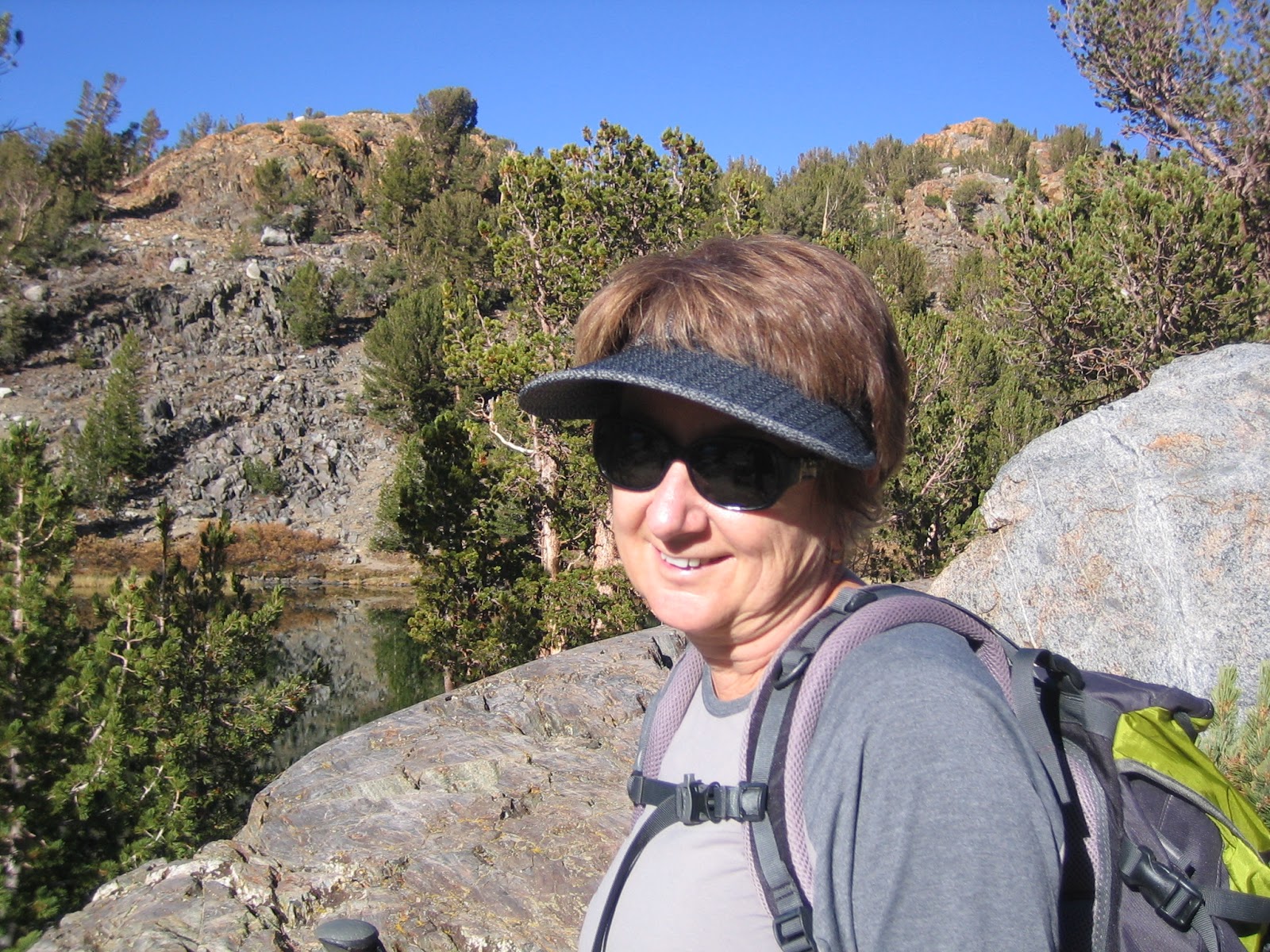
Kathy and Marty headed up to Duck Pass (click to enlarge)

By the time we made it to Duck Pass, I felt pretty wasted. We kept going for another few hours and had lunch of flour tortillas (do these things ever go bad?), salami, one slice of cheese and mustard. Immediately I felt less dizzy and disoriented. The mosquitoes were terrible, but that's what Jungle Juice is for (96% deet and toxic). Off and running again and had a nice hello with three Latinas from Mexico before heading up towards Virginia Lake. The drill on the JMT is to do a pass, hike down into some canyon or other and position your party for the next pass. Marty has done the JMT 3 or 4 times and can read maps well, so he is the boss man. I'm feeling really tired.

Second night, I found the camp. It was so close to the trail that we heard the campers going by until 7 or 8 that night. Kathy is very strong and taking Zquil at night, so sleeping like a (baby, no race horse). I'm just hanging on and trying to breathe through the night. Thinking that 11 or 12 days of this and I may be meeting my maker. I guess this is a good place to die, but don't really want to for 100 years or so. That would make me the oldest guy on earth at 174.

The next day is to be a big one. We are to do Silver Pass (10.7K feet elevation). Marty is a little slow today, don't know why. He has a funny look on his face when we do a creek crossing, but I'm too concerned about myself to ask him what's going on. The mosquitoes have reached a new level of hatching and most hikers are in long pants and head nests. I chicken out and change into my water shoes to do a crossing, as the water is high on most creeks and the risk of a water fall makes me a little conservative. It takes me 10 to 12 minutes to change out of my shoes and socks, get them on the pack and use my Crocks to cross. Kathy is much better and quick handed manual stuff and is probably at about 5 minutes. Marty and I look at each other but selfishly I just want to get away from the 100 or so mosquitoes that are loving me to death.

Kathy at Silver Pass

At the summit of Silver Pass we have a lunch break, but quickly finish our meal and are on our way because the sun is so intense and there is no shade. Further down on the south side, we find a tree which provides some respite. Marty works on his heels, and I see why he has been preoccupied. His heels are beyond blisters and are now raw flesh. When we are leaving, Kathy asks me in private whether she should offer him the option of going back. I agree and she went back to talk. He decides to continue and I am secretly happy with that decision because the way back seems so difficult that my confidence in getting back is not high.

Beauty and Beauty

The John Muir trail was started in 1914 and completed in 1938. John Muir, first president of the Sierra club, proposed the trail to the state legislature initially. The reason for this span of time was the amount of blasting that had to be done to carve a trail out of near vertical rock. The latter part of the day we saw why it took so long. But first, as we were proceeding to what Marty called a parachute drop, I slipped on a creek crossing and fell on a downed tree trunk. The under side of my arm was bleeding pretty good. There were as many flies on this trip as mosquitoes and they quickly started feeding. Kathy wrapped the gash with a bandanna and this solved the problem. We began dropping down a trail literally carved out of rock. It was steep and had big step downs similar to the route to Whitney. As usual, we wanted to get close to Tully's Hole to get a good jump on Bear Valley Ridge. This strategy is used to avoid being out of light at a high point where weather might come into play.


At 8400 feet elevation we finally found a campsite close to water and pitched camp after a 11 hour day of hiking. We are all using two poles, which reduces the stress on the knees by 30%. However, my right hand is getting overused with the poling, packing and assorted buckling. It starts to freeze in odd positions with fingers pointing every which way and won't cooperate with my conscious control for minutes at a time. We are in the middle of nowhere and this trip is starting to spook me. Kathy suggests that I just use my left pole tomorrow and as usual her advice lets me relax a bit.

Bear Valley Ridge flowers

The next day we proceed down toward Tully's Hole and as we get closer, the mosquitoes become relentless. We all are happy when we hit the switch backs on Bear Valley Ridge. It will gain 1900 feet in 2.5 miles, but the flowers and ferns are a wonderment. Marty is slow due to the pain with his heels and Kathy is strong as ever. We regroup at an overlook of the valley that leads to Sheldon Pass. We meet a man and his son from Minnesota. He says that the mosquitoes in the valley are much worse that anything in his home state! Oh boy, can't wait. We want to get as far as possible to not get stuck on the high part of the pass tomorrow night. Finally, we find a campsite right next to the roaring creek and enjoy some rest.

Tame Deer enjoying a snack

The water is very high through the valley and the next day we are in the business of water crossings, feeding mosquitoes and swatting flies. Marty confided at a later point that on that day he began to regret that we had not turned around at Silver. He brought up the possibility of a early termination of the trip and an exit over Piute Pass. I loved the idea.

It's always nice to get to camp

 The upper reaches of Sheldon were spectacular. In meeting the people sharing the trail with us, it became obvious that the composition of the hikers was at least 50% from other countries. Mexicans, Spanish, Germans, English, Aussies and Scandanavian were all represented. Many groups of young women and single women were also on the trail. The 220 miles of the JMT are unique in that the wilderness is not crossed by roads of any kind and the only signs of civilization are the jets that occasionally fly overhead.

Obligatory reflection below Sheldon

Marty near the top of Sheldon Pass with forever to the north
 On the pass the clouds are getting darker and look very threatening. Kathy asks me if it is safe for us to be on this exposed spot and I reply "probably not". We decide to try to take the first campsite we can find. At the second lake down we just beat a couple of people and start putting up the tent. The other people come and camp close to us. They are the same ones from Alabama that got close at the last campsite. We laugh about it and are in good spirits as Marty gets to camp and it starts to rain gently. Afternoon thunderstorms are the rule in the high Sierra and it is usually no big deal. We are at 10.2K however and I don't have a warm fuzzy about being this high in possible weather.

The calm before the storm

After a few hours of rain and some thunder we have a break and get some dinner. At about one hour, the sky turns dark again and it starts to rain and blow in earnest. For the next 6 hours we witnessed one of the most violent storms that I have experienced at altitude. The 15 year old Sierra Designs tent is a bit tall for a good mountain tent, which creates a sail area in strong winds. The pole structure is strong and well designed however. The first four hours had both strong rain and gusts over 50 mph. The sides of the tent were hitting us in the face if we sat up. The thunder was impressive in loudness, but there were no lightning strikes close to us. A little moisture would occasionally get through the weather proofing, but all in all the tent held up well. It was a scary experience and no sleep was possible. Finally, the winds abated and we slept deeply with relief.

The next day we hiked to the Muir Trail Ranch, picked up Marty's food supply 5 gallon bucket and took just enough to get us over Piute Pass. The ranch packs supply buckets by horseback from the western flank of the Sierra for $80. If you don't pick up your bucket, they will mail it back to your, which Kathy and I elected to do. We then proceeded to the Piute Creek bridge (elevation 8200 ft), where we camped in a nice clearing, surrounded by healthy Manzanita bushes. The Piute Creek was raging and loud, but there were virtually no bugs and we enjoyed some shade and rest. Our mood was good and Marty was able to text his wife Leslie and son Colin to arrange for a pickup at North Lake on Sunday, two days from now by using his In Reach sat system.

On the Piute Creek bridge

The trail in the lower reaches of Piute Canyon gains altitude by using the high step up construction, which is quite exhausting but gains a lot of altitude quickly. Kathy again displays her superior aerobic fitness and I don't see her for an hour or two. We will gain 1800 foot today and using some tired legs to do so. After Hutchinson Meadow, the amount of water across the trail is more than I have ever seen in the 25 years of going there. The snow pack was only 40% of normal, but all this runoff is coming from where? It reminds me of some years in the Anza Borrego desert, when creeks flood in what the stats show as so so rain winters. There are so many creeks crossing the trail after Hutchinson that the trail is easily lost. Once again, the bugs are very happy. We finally reach our usual campsite at 10,000 ft. It is into the tents and read the kindle time because the flies and mosquitoes are dense. Luckily I have a great book: "The Evolution of Beauty - How Darwin's Forgotten Theory of Mate Choice Shapes the Animal World- and Us" by Richard o. Prum. The bugs are so bad by dinner time that Kathy elects to skip dinner.

Marty is one tough hombre

Kathy always says that I'm too competitive and maybe that's true. But I do sense opportunity when it arises. Kathy had no dinner last night, but I ate a big one, freeze dried beef stroganoff  and bugs. This could be my chance to be the first to Piute Pass and some redemption. I pace her at the start but hang back a little. We have about 1500 ft elevation gain to the pass, no need to burn out early. Finally, my time comes and I start the engine. Towards the cresting of the switchbacks there is a point where you can see the pass and the trail gets easier after a water crossing. Near the top I stop to dig a hole and have a bathroom break. As I get to the water crossing to my dismay I see Kathy putting on her shoes on the other side. Damn! My slow change to water shoes will not do now. I take my chances on a poor rock placement and slip to a full submerge and hit something along the way.

I am completely soaked. Kathy offers a hand to get me out. Double damn. I change and wait for Marty, the race is officially over. I put the wet stuff in a sack and stop to take a pee. Unfortunately, I am peeing blood. Kathy consults Marty, who is a retired ICU nurse supervisor. He says force water to avoid a clot that could stop up the water works. I am feeling a bit tired and woozy but start powering the water and Kathy helps me keep the water bottle full. By the time we get to North Lake I have drunk about 3 or 4 quarts and am peeing clear. Whatever happened fixed itself.

It was great to see Leslie at North Lake and get in a car to go to the Best Western in Bishop. After checking in Kathy and I borrowed the car to get our truck at the Cold Water campground in Mammoth. Upon return, we had a shower and shared some good times with Marty, Leslie and Colin in their room. We then celebrated Colin's entrance to a Singapore University MBA program at the Whiskey Creek Inn in Bishop that evening. One of my best trips ever.


Wednesday, December 27, 2017

Coyote Mountain and Christmas in Anza Borrego

Coyote Mountain from the South
(click on photo to enlarge, exit back with x in top right )

We had planned a quick 4 day vacation in Borrego Springs when Kathy was working close to full time as giving child care to our grandson Zack. The money was paid for the campground and we were going to use our mini ten foot Carson trailer, while Zack was visiting the other grandparents in the Bay area.

Looking for fun things to do in the San Diego area, Afra had invited me to hike with some non Sierra Club groups with similar interests and no worries about rules and regulations. The go to book for these outing is "Hiking in Anza-Borrego Desert Vol 1 and 2" by Robin Halford. A few weeks ago one group did the Vista del Malpais hike and I really liked the loose format and low key people who were at the same time very competent.

Walking the rim of the badlands near Font's Point

The second group that Afra hikes with does a monthly hike. My first one with them was one of Halford's called Paul's Playa. It was also a great hike but taking a steep approach to the bumps in front of Coyote Mountain (from the Pegleg Mounument on the South side). It was a hard hike of about 6 hours. Jim had left a few hours early and was going to also climb Coyote. We waited for him at a high point rather late in the day, so the peak was not an option for the rest of us. I was a little disappointed, but it had been raining a bit and by the time we got back I knew it was the right decision. 

When we reached the campground, Kathy said she wanted to do something hard, like Villager.  I suggested that we do Coyote Mountain, from Rockhouse Road by the Clark's Dry Lake on the East side of the mountain. Although short (5.6 miles round trip) it is rated very strenuous by Halford. Since Paul's Playa was rated strenuous, I knew this was going to be a challenge. There was little surprise on my part when Kathy was all for it.  It was in the mid thirties that night, so we left a little after 8 and left the truck about 9. 

Through the flood plain to the start of the ridge network

We had a few false starts until the All Trails app helped us get on the right ridge. It is further North than your instincts might discern. Kathy and I have had practice at heated discussions and there was no way I was going to be too assertive and be headed back to camp early.

On the ridge at last and getting somewhere

The going was hardest at the beginning and toward the top

Kathy and I had started this hike with minor foot problems. I was recovering from a stone bruise on my heel from the Paul's Playa hike and Kathy had a toenail that was digging into her toe. As the day progressed, the rough terrain began to play on these weaknesses. The false summits were a bit hard on the optimism that we shared. The only thing that kept me going was I knew that there was way too much investment to turn around. It was not a safety issue on the foot problems for me, just a strong desire to make to the top and get going back down. We were probably hungry, it had been long time since breakfast. We shared a Laura Bar and kept putting one foot in front of the other. The top section  has a lot of chollas and the wind has done a good job of littering the surfaced with the little buggers.  The route going up is hard to see because of the steepness of the terrain. 

Finally, we reached the summit plateau. The view towards the badlands with Clark Lake in foreground

Kathy on top, looking a little more towards the South

We signed the register book and had a nice lunch. The whole hike was unusual in that the wind never picked up and the temperature never reached 70. A perfect day for an adventure where we weren't sure of a positive outcome.  On way down it was much easier to see a defined use trail, a bit more to the North from how we came up. The down climb was much easier than expected on the slippery small scree like conditions when using a side step. However, the new Montrail trail runners I got to overcome last week's heel problems still seem a little too lightweight. They work great in the Sierra on real trails, but in the point to point steep desert conditions, not so much. By the time we got back to the truck, my heel bruise was much worse, but we had plenty of medicine back at the trailer to make things right.

Stats: 2600 feet elevation gain and 5.6 miles round trip
rated very strenuous by Robin Halford

We rode bikes the next day on the Peg Leg loop and admired Anza's Angel on our now favorite mountain. By coincidence, we were riding on December 24, the same day in 1775 that the "angel" was seen and supposedly used to find the way to the coast. More likely they used a Native American to guide them as they were quite familiar with the route.The following day I rode my bike again because of hobble issues and Kathy hiked the Palm Canyon. No mountain sheep sited, just foreign tourists.


Wednesday, December 6, 2017

Three Passes in 3 days and the Sky Rock

Kathy had a reminder from two years ago on a post that I did on Bow Willow, a favorite camping place in the Anza Borrego desert. She gently spoke of my writer's block since then. Actually, it wasn't my last post. I did one on Denny, which was used as the eulogy at his funeral. Kathy thinks my concern with Denny's loss ( and Jon not too long before) was more to do with my own concerns with mortality and there is probably some truth to that. In any case, our recent trip to the Eastern Sierra seems like a good topic to get back on the horse and get on with things. Winter is coming.


We were staying at the Elm's Motel in Bishop. It is off the main street and next to a park, very quiet but a bit dated. Each day we would partake of the Spartan continental breakfast early and get a good start on the day's hike. The first pass would be the hardest, Bishop Pass. It usually is a menage of hikers, climbers, fisher folk and others that resist easy classification. The late November uncertain and colder weather thins out the crowd, so it was a perfect clear day which provided the stage for our adventure. At the parking lot the temperature was 30 degrees and we were the only car in the lot. I was thinking that maybe the locals knew something we didn't, but we packed up and headed up the trail.

  View from tarn towards Bishop Pass

South Lake is full, whereas last year the water didn't even reach the dam. It was a great water year for the Sierra. As we hiked in the shadows it was cold, but felt perfect in the early morning sun. It feels so good to be doing something with Kathy that we both enjoy. She has been on an extreme child care schedule, rising at 4 am and getting home at  7 pm. Tyler's mother is visiting this week and so we are free! There are no people ahead of us and I am starting to get acclimated to the altitude and beauty.

My favorite hiking companion

There are a lot of "step up" rocks on the Bishop Pass trail. With a full snow load, route finding is an issue. Today, there are patches of snow, but mostly the trail is bare. The cool weather allows us to make good time and Kathy is very fast and strong. At about 10,500 feet, I am starting to get stronger. In years past, things were different. Like many other facets of life, looking too much in the rear view doesn't help.

   Long Lake toward Bishop Pass

  Looking back toward South Lake

At about the four hour mark it was obvious that the summit block had snow. The trail has been expertly laid out and somehow the drifts never quite cover the short switchbacks that make the difference between easy hiking and something more serious. There is plenty of exposure and with careful footwork the patches of ice can be avoided. It's windy going up the head wall, so we stop in a protected place to eat lunch. It turns out it was less windy on top at the pass, where there were a couple of snow fields to be negotiated. After the obligatory summit photos, we head back down. The views are very spectacular on the way down and we are very happy with having made the hardest pass on the first day.

   Kathy almost at Bishop Pass

We remind each other to be careful on the down steps, as we haven't seen anyone on the trail and a turned ankle or some other lack of concentration would be a bad thing. Cell phones don't work up here and so you can't call your way out of a mistake. At the eight hour point we have made it back to the car without having seen anyone else on the hike. What a gift and adventure.


It's nice getting back to a motel room with a nice heater. Also, in a change of season trip the extra room from our bare bones trailer is much appreciated. We have room to keep the packs pretty much out of the way and ready to go for the next day. It's also a treat to get some Pollo Loco salads for dinner and enjoy some wine while talking back to the TV news.


Our second hike is an easy one to Morgan Pass. It is in the Rock Creek Canyon, also known as Little Lakes Valley. The parking lot is at 10,000 feet and the trail roughly follows the series of lakes that lead up the top lake (Chickenfoot) and then to the pass. Because the trail has numerous water crossing, it is a big help to have most of it free of snow. The parking lot was again 30 degrees, but the trail can feel colder because of the proximity of water.

       At Long Lake with Morgan Pass off to left of frame

I had bought some Bandini gloves, made for the cold Laguna mountain bike rides. I saw that Kathy had some lighter weight gloves, so decided to man up and use a similar pair. Within twenty minutes this decision seemed foolish as my hands were aching. Note to self: Kathy is 15 years younger and has better circulation in the extremities. Next time, be smarter about taking the right gloves. Being in the Sierra above 10,000 feet slows down the efficiency of the central nervous system and one needs to deal with the reality rather than how you feel things should be.

            Looking back toward Little Lakes Valley almost to Morgan Pass

Once we get out of the shade and the sun starts to creep above the mountain scarp, we start taking off layers and enjoying the fantastic views. Because we didn't get in a Sierra backpack this year, it is great to be making good time and not really having any significant issues. We have microspikes in the pack, but after yesterday I don't think that they are going to be necessary. The patches of ice are small and by good footwork can be avoided. Little Lakes Valley is a hike that anyone can enjoy with reasonable care because the trail is obvious when not covered in snow and the elevation gain is very gradual. Consequently, it is one of the most used areas in the Southern Sierra.

    Mount Morgan from the pass

Morgan Pass is free of snow and we enjoy a nice lunch there. The down hike is much easier and faster than Bishop Pass because there is more of a gradual descent and less rock steps. This is a great cross country ski basin and they have a California Snow Park area at the bottom of the steep hill that leads up to Mosquito Flats, where our truck was parked. This means that with a $30 yearly pass, you are assured of a plowed road to that point. When there is no snow, you don't need a pass. It is more dangerous in the spring, when the solid winter pack starts to degrade and you can break through into a stream or lake. In the winter, you should check the avalanche forecast as in certain places the sides of the canyon are quite steep. The Rock Creek Winter Lodge is a few miles below Mosquito Flats and offers rustic cabins and great food.

Kathy's toes are starting to get a little worse for wear, but we want to do Mono Pass. The ranger didn't know the present conditions, but we can always turn back if things look dicey. I did Mono with a full snow load with my brother Marty on skis, but that was almost a lifetime ago. There is some beautiful above timberline scenery and looking forward to this adventure which is probably in between Bishop and Morgan Pass in difficulty.

     Kathy looking toward Morgan Pass from Mono trail

We leave the parking lot with the temperature again stuck at 30 degrees. I've got my heavy gloves on and after a mile or so we head off to the right at the Mono Pass signed trail. It is very south facing and becomes too warm very quickly. As we shed clothes and gain altitude, the whole basin comes into view and it is spectacular. The trail is the best of the week, with a nice, soft sand component that although steep, is never scary. Ruby lake, a favorite for back country skiers, comes into view beneath us and the long switchbacks get more steep.

     Above Ruby Lake on Mono Pass trail

 
Mono Pass


Finally, we get into the summit canyon and begin to pick our way through steep rock and giant boulders. It's a fun hike and we haven't had to deal with any snow or ice to this point. It looks like there will be some snow to negotiate at the pass proper, but even this is not necessary as there are many paths to the side of the blockage. No question we are at altitude as the place looks like a scene from some SF movie. As we get a little beyond the pass, Summit Lake comes into view. We decide to save looking down Pioneer Basin (which leads to the John Muir Trail) for our hike next year. On the way down the views are even better. It has been a great day.

          Summit Lake above the pass

   Kathy headed back to the truck

We have been trying to find Sky Rock, a native american petroglyph which is in a volcanic bluff section above the Owens River. We park the truck in a small turnout and gain the three or four hundred vertical to the site of a rather large collection of gigantic volcanic boulders. It probably stretches for close to a half mile, so just getting here is not finding the rock art. I work my way through a weakness in the bluff, but have really only succeeded in making communication with Kathy very difficult. She, on the other hand, it looking for a tell that involves one giant boulder leaning on another. Unless you were Superman, who can leap over buildings with one bound, it is no easy matter to survey things from the top, where I am. Don't really want to make any mistakes that might put me in the ER.

  Trail to the "Sky Rock", Mt Tom in background

I see some tracks and get within a few yards of the site, where I can see the moons of the composition. Not good form to get anywhere on the "canvas" as too much love has desecrated many of these sites. Kathy has found  the rock on her own and we find a way for her to get to my point safely. What a rush! This whole week has been a coming together again and I am so happy to be sharing this experience with Kathy.

    Sky Rock


Thursday, December 17, 2015

Where's Denny?


Denny climbing Fossil Falls, North Rim of the Grand Canyon
    Click to enlarge any picture hit X in upper right to return

Denny grew up on Twin Oaks Circle in Chula Vista. It was off the main street and had a small town feel. This is where he met Joe Laplante, who would be a best friend for the rest of his life.

Denny and I met in the 4th grade at St. Rose of Lima. We started our friendship making money on marriages as altar boys. Jay Hollister, an ex marine who fought in the South Pacific, took care of our physical training in sports while the Benedictine Sisters did their best to curtail our bad behavior with ruler discipline and public humiliation. Most of the time it didn't work.


Denny is front row second from right. He was the math genius in elementary school, but had only marginal interest in the other subjects. He saved all his money from his paper route to build up a hot rod for high school. It was a beautiful 34 Ford with a big engine his father helped him rebuild. He went to Chula Vista High while I went to Hilltop. We both continued on to San Diego State and managed to survive motorcycles and free fraternity beer. He sold his motorcycle to get a big ring for Margaret, the love of his life, toward the end of his stay at SDSU.

In the coming years Denny became the stand up guy that you all know and love. We had many family adventures in Baja and were partners in a cabin south of Rosarito. He loved the ocean and enjoyed fixing up the cabin with a flush toilet and drywall, whereas I mostly just enjoyed surfing. Denny and I have always been quite different, but he didn't need others to be like him. Most people try to make themselves and their choices "right", but Denny didn't have that gene.

Denny started his own software company, which involved data collection and analysis on tactical systems. While he was doing this work, he continued to develop a string of rental houses and made upgrades to most of them. At one point I was between jobs and worked for him. No one could match his energy and productivity. Most tenants loved him because he gave good service and frequently counseled them on how to get their own place.

His physical exploits are legendary. In college, he benched over 240 lbs while weighing around 120. He had a string of 30 consecutive half marathons and after 60 did a few marathons. We did a few mini-triathlons together. He had the balance of a cat and no apparent fear of heights. When he mountain biked with our weekly group, he kept up well without being there often. This usually involved at least one fall, but he never seemed to get hurt. I saw him do things in Sedona that showed a complete disregard for a bad outcome. Kind of the opposite to the way I ride.


We took Denny backpacking to Big Pine Lakes, North Fork drainage about 20 years ago. On the first trip he found our favorite spot. It is nestled on the top of boulders, looking across 2nd Lake to Temple Craig. Denny quickly learned how to fish that lake and displayed his cooking acumen with the fresh trout. His sons Patrick and Michael, daughter Jennifer and our daughter Allie accompanied us on many of those adventures. During the last few years, most of the time it was just Kathy, Denny and I when we made our yearly pilgrimage to the eastern High Sierra.

Denny and Jennifer, looking back toward 2nd Lake

Second Lake, looking at Temple Craig

Here's where the "Where's Denny" starts to rear it's ugly head. There had been a few precursors on mountain bike rides, but I chose to ignore the warning signs. Denny was so focused that he could lose the group in minutes. From that point on, Dan volunteered as sweeper and he kept Denny in sight.

We began to do point to point backpacks (moving each day) with Denny and discovered some interesting things.  He could rebuild an Aston Martin using 5 gallon pails to pile the parts.  He said "It's kind of obvious how it goes together" (!).  However,  packing a backpack could be almost a perpetual motion exercise. Time for a break?  Oh no, he's dismantling his pack again! I used deep breathing and other techniques to keep my compulsive nature in check.

His disappearances on the trail took epic proportions. The great part of it this year was that it got to the level of a joke between us.

Three months ago, we were going to repeat our 5 day Piute Pass to Bishop Pass loop of a few years ago. We left the North Lake car campground early. At Piute Pass, Denny told us to go ahead and he would catch up. Unfortunately, the Rough Fire had carpeted the entire southern Sierra. The closer we got to the John Muir Trail, the worse the smoke. Kathy and I retreated back up the canyon to a flat camp place.

We were worried about Denny, because he was two hours getting to the camp. "Where's Denny" became our mantra. There was palpable relief when he came down the trail. He had gotten on a side trail while coming down, but was in good spirits and completely comfortable. Denny wanted to go on. There is no quit in this guy. I was conflicted because Kathy was coughing so badly that she was not able to continue. We were elated when Denny decided to go back with us rather than continuing on by himself.


The next morning Kathy and I were packed. After about a half hour, Denny told us to go on ahead and that he would catch up. By midday we were over the pass at Piute Lake and began to nap on some boulders while waiting for Denny. After the second hour of waiting, we began to question the few hikers that came by to see if they had seen Denny. Of course the mantra began anew. When he got to us an hour later, Denny was in great spirits. Time for him was just a four letter word.

When we got back to our favorite car campsite at North Lake, I started a fire. We bought some wine and had one of the best campfire conversations of my life. Cells of weather brought light rain, but it didn't matter. We were upbeat after having done 30 miles and Piute Pass twice in two days. Denny said that he and I were so lucky to be able to do these trips and that we would continue to do them together until our 90's.

Whether it was a five cities ride, a snow climb of San Jacinto, a cross country ski up San Gorgonio or just a hike up Iron Mountain, Denny was my go to guy. Whenever you went anywhere with him, his ordinary transactions were characterized by a kindness toward others and a complete occupation of the present moment. All of the people who worked for him knew this. One of the things he did last year was to look up an old employee, who had been deported to Mexico. He was living in Rosarito and had virtually no teeth. Denny picked up the tab for him to get them fixed. Who does this kind of thing?


For as many seasons as I have left in the Sierra, I know part of my experience will be the eternal quiet that soothes me. But every trip, from this year forward, will have that feeling at least once when I look back trail and repeat the mantra   "Where's Denny?"

Saturday, November 21, 2015

The Ghosts of Bow Willow in the Anza Borrego

(click on picture to enlarge, click on x in top right to return)
                                                     
Bow Willow campground is located about 15 miles from Ocotillo on Highway 2. The turnoff toward the west is just past the Carrizo Wash. We have been going there since the early 90's. My grandfather had a place in Ocotillo in the 50's and I went there frequently to hike and shoot .22 rifles at beer cans and other assorted targets. My grandfather and I would eat at the Miller's Cafe and go to the Miller's garage for men talk. Here is what the Miller Garage looks like now:


Since Ocotillo is not in the Anza Borrego State Park, it has become a focus of the alternative energy plan of SDG & E. My grandfather probably would have considered this catastrophic. The native Americans who endured the white guy migration probably would have gone along with this assessment. OK, Miller is one ghost down.

The next ghost is the ghost of the "gol danged" Indians. If we are talking about a percentage blood type to get a good monthly stipend, we are not on the same page. "All the Wild and Lonely Places" is kind of my go to book on the Anza Borrego, its people and  history.

 I am seeing big holes in rock made by these people. This did not happen overnight!


This is seventy feet from our campsite. There were at least 14000 people here when the newcomers came and started their deal at about 1830. At the turn of the century, there were about 1,000 left. Assimilation means you are the losers. Good luck to the casinos to get some of it back.

If the truth be known, many times truth is in the heart of the beholder.The indigenous tribes  knew water sources could become dry and lakes disappear... .In 1992 and 1993, water filled the Bow Willow Creek!


This is maybe a quarter mile from the campsite. Water is everywhere.

Things change. If you are a local in the 1800's, things are changing very fast. Your people are getting sick from weird diseases. The whites are grabbing the good hunting land to feed their cows.Your  bows look weak in comparison to a repeater. God, this is not fun and the outcome looks pretty certain.

So, we are having a fun vacation and the ghosts are upon us. Kathy remembers Alli with us at Bow Willow in the early 90's. I remember my grandfather at Ocotillo, telling me that we are lucky to experience this. We both remember the shared times with our friends in times past. Who doesn't remember something about the past that is associated with a place that we revisit?

So, here I am.I'm thinking about my grandfather, who did all deals on a handshake. I haven't done many deals lately with a handshake.

So, Kathy and I are still thinking about our friends and family at this place we have been for 20 plus years. Somehow it is not the same with just us. Do we require the quietude that surrounds us every moment?

Do we learn from the quiet that has been created through the white man's rediscovery of a place that wasn't a "wild and lonely" place in the past?

Chief Francisco Patencio says:
" All the wild and lonely places, the mountain springs
  are called now. They were not lonely or wild places in
  the past days - no. They were the homes of my people,
  who lived contented and happy. Sometimes an Indian
  goes back into the mountains to a spring of water.
  There
  he visits, alone the home of his ancestors."

Hogue in AWLP  cites:  "When the time comes" they (the Cahuilla) would say, meaning that catastrophe could strike at any moment. We look at the difference between 1992 and now in Bow Willow Creek. Now the creek is dry. 20 years ago, it was a paradise.


So, as you may have guessed, my deal is the nature of change. Your mother dies, it is a terrible thing. My mother dies and it is a catastrophe. The closer to home the more the tragedy. My problem is that the tragedy was for the native american people, not the inclusive us.

The native american lived closer to the land and understood that big change was just around the corner.  A careful observer of the desert sees overuse of ancient water vaults. The book "Cadillac Desert" documents some of our arrogance toward this precious resource. What will the future hold for us that have been here a few hundred years? Sometimes science fiction isn't about space ships and alien beings. The book "The Water Knife" (by Paolo Bacigalupi) instead uses the theory of "Cadillac Desert" and paints a picture of states and power barons fighting over the water rights to the Colorado river. Phoenix and other cities become losers in the water struggle. The inhabitants are thirsty and subject to the rule of gangs and thugs. It isn't a pretty picture.


This is looking up Carrizo Gorge from Egg Mountain. To taste it's secrets, carry plenty of water and hope for a breeze. Bring a stick to scare off the snakes! At the top is the giant wood trestle.

So we are going to do Canyon Sin Nombre on mountain bikes tomorrow. Love the adventure of this ride and the fact that Kathy is going to do it with me.


The route is quite simple and here are instructions and a map to help you do it. Take the dirt road from the campground and go back to s22. Turn right on the pavement and proceed up Sweeney Pass. Close to the scenic overlook of the badlands, drop down Canyon Sin Nombre at the above sign. Enjoy the passage through the canyon and it's story of geologic time. When you are through the canyon, turn left at the first junction and head west toward Sombrero Peak, using Carrizo Creek wash. You will pass a Tamarisk grove (called "the trees") just before making it back to S22. Go north and they retrace you downhill ride towards the campground.


On a mountain bike, downhill in soft sand is really fun. Keep the speed up to stay on top and just point it. Going up hill, not so much. The good part is going up to the top of the hill on a paved road, then hitting the overlook and giving a hoot all the way down to the trail that hooks back up north towards the west.


Toward the top and with Sombrero Peak towards the right (west) side.


After reaching the bottom of the canyon, take a left and head back toward Sombrero Peak (west). It is a mild uphill filled with creosote bushes and their colonies. One such colony in the Mohave is estimated at over 10,000 years old. The desert people used these bushes to help cure 14 different conditions.

We arrived back at the campground, a 15 mile loop. Fortunately, it was 5 o'clock somewhere and we celebrated our good fortune with a nice glass of wine.


If you have Google Earth installed and want to take a virtual tour of the bike ride: Click on the link below to download the kml file of the ride. A map will come up with the menu on the left top side. Select "File" and then "download". The kml file will be in your downloads folder. Click on the kml file and you will activate Google Earth and can get a bird's eye view of our route.
Click here to download kml file