Monday, July 20, 2026

The Puetz Valley McCormick/Hoffner Connection


I remember when mountain biking with Bill Harold in the Lake Jennings area, just west of Alpine, that there was a road called Puetz Valley Road. This name rang a bell in my helmet covered brain. My father had directed me to do a family genolgy analysis with him paying for a month of Genolgy.com for me.  The name Puetz had been on the Pedigree on my mother's side. 

The far right of the chart is the line of John Puetz of Luxembourg married to Marie Schmitt of Trier. Their offspring  was Magdalena Puetz, our Grandpa Ben's mother.

When I worked in Germany, I went to Trier often because it was fairly close by train. It has  an almost intact Roman Outpost, complete a big colsium. You could almost hear the cheering crowds and luckless participants. Trier is on the way toward north towards Luxembourg and France.


I did an AI search on Peutz Valley and found this reference: (Peutz/Puetz are both used)
     " Peutz Valley, located on the western edge of Alpine, is named after German
       immigrant Nikolas Peutz, who settled there in the 1880's. He capitalized on
       the local coast live oak to produce charcoal, which he sold to the San Diego
       butchers for smoking hams, while also running a successful livestock and 
       produce ranch.

       The history of the valley is deeply rooted in this rural agricultural heritage. 
        Here are the key details of the valley's development:

        Pioneer Days: Puetz famously established his ranch and later sent away for 
         his mail order bride in the early 1900's.He became well-known for traveling
         by horse-drawn into downtown San Diego during the holidays to sell hundreds 
         live turkeys to the city residents. "


The "Anton Puetz Family of Wisonsin" is my primary source for this post. One page is particularly relevant to understanding the Hoffner/Puetz side our family tree:

                  Luxembourgers In Wisconsin

The little duchy of Luxembourg has given Wisconsin some 12,000 citizens, most of them living in only three of the state's 72 counties. But the Port Washington area contains one of the largest settlements of Luxembourgers in the United States.

They began to arrive in 1844 and because Luxembourgers are strongly nationalistic, and wish to live together, others soon followed. In 1845, 15 families arrived in Milwaukee and sought advice from Archbishop  John Martin Henni.  He counseled them to settle in, is now called Holy Cross, in Washington County. By 1848, The following year, 10 families formed the Lake Church settlement near by. Others formed small communities in and around Dacada, Fredonia, and Belgium, all in Washington County. By 1848, there were 80 Luxembourg families in the Dacada region in Washington and Sheboygan Counties. Ozaukee County was formed in1853.

The majority of immgrants came from the Grand Duchy proper, or from what remained of it, and some came from a former territory of Luxembourg, chiefly from the province of Luxembourg, in Belgium. They were politically Belgian, although culturally and linguistically Luxembourgers. Hence the name of the the community of Belgium.

 The official language of the Grand Duchy of Luxembourg is French, German, and a widely spoken native dialect, called "Letzeburgesch".

Luxembourgers are splendid farmers, hard working, eager to raise the best possible crops. They are thrifty and individualistic.

They still adhere to the old Luxembourg motto, "Mer wella beiwe wat mer sinn". Translated "We wish to remain what we are".

Occasonally, one may discover unusual plants growing in the vegetable gardens of Wisconsin's Luxembourgers, shallots, chives, small onions with a mild flaor for use in stews and soups and most of all, "bounabourg krautchen" or Summer Savory, especially good in "Moos Treipen", a Luxembourg sausage, meat loaf, hamburgers and dressings.


Additional notes from the area settled by Luxembourg immigrants cited that the standard lot size for farms was forty acres and consequently was quite inexpensive. The newcomers were used to small farms and intensive improvement of the soil.


It should be noted that this Ben Hoffner is our Grandpa Ben's father.


Nicholas was the younger brother of Ben's mother!


I think mother Mary added this to the Puetz book


Grandpa Ben, Kings Canyon Back Country Ranger
I think he may have become good with horses on the Puetz Valley Ranch.


Thursday, September 14, 2023

Bishop Pass from South Lake


 Screenshot of the route

Well, the breathing trick allowed me to keep up with Kathy for a change. I consider this hike to be one of the best in the Sierra because it is difficult, but not for the usual reasons. The Piute Pass trail out of North Lake is made for horses, with big drop steps. It's hard on the horses too. On our last hike there, Kathy and I saw one sympathetic cowboy get off and lead his horse down the steps. 

We got to the trailhead at about the same time as yesterday, about 8:30. The temperature was warmer, about 40 degrees. My pack was completely prepared because I knew what was needed and packed the night before. We got out of the van and started at a good pace with me using the breath step, emphasizing the exhale part of the cycle. It worked and for the most part I kept up with Kathy. 

The trail had a strong female presence and the people we met were either neutral on greetings or friendly. The trail was in excellent shape. The Bishop Pass trail always means coming home, because it is an easy pass to exit from the Le Conte canyon. One common route is from North Lake, over Piute Pass down to the JMT and then south  over the Muir Pass and back over Bishop Pass to South Lake.


Denny on the Piute Pass to Bishop Pass loop 


We joined up with friends that did the Lamarck Col shortcut at the Muir Hut

The shuttle from North Lake to South Lake can be done within the highway 168 in a matter of 20 minutes or so. Kathy and I have also done the Kearsarge Pass to Bishop Pass, but it requires having two cars and the drive back and forth from Big Pine. Here is the write up for that one:


Approaching the headwall


Slightly wider perspective


Going around a corner to get to ramp

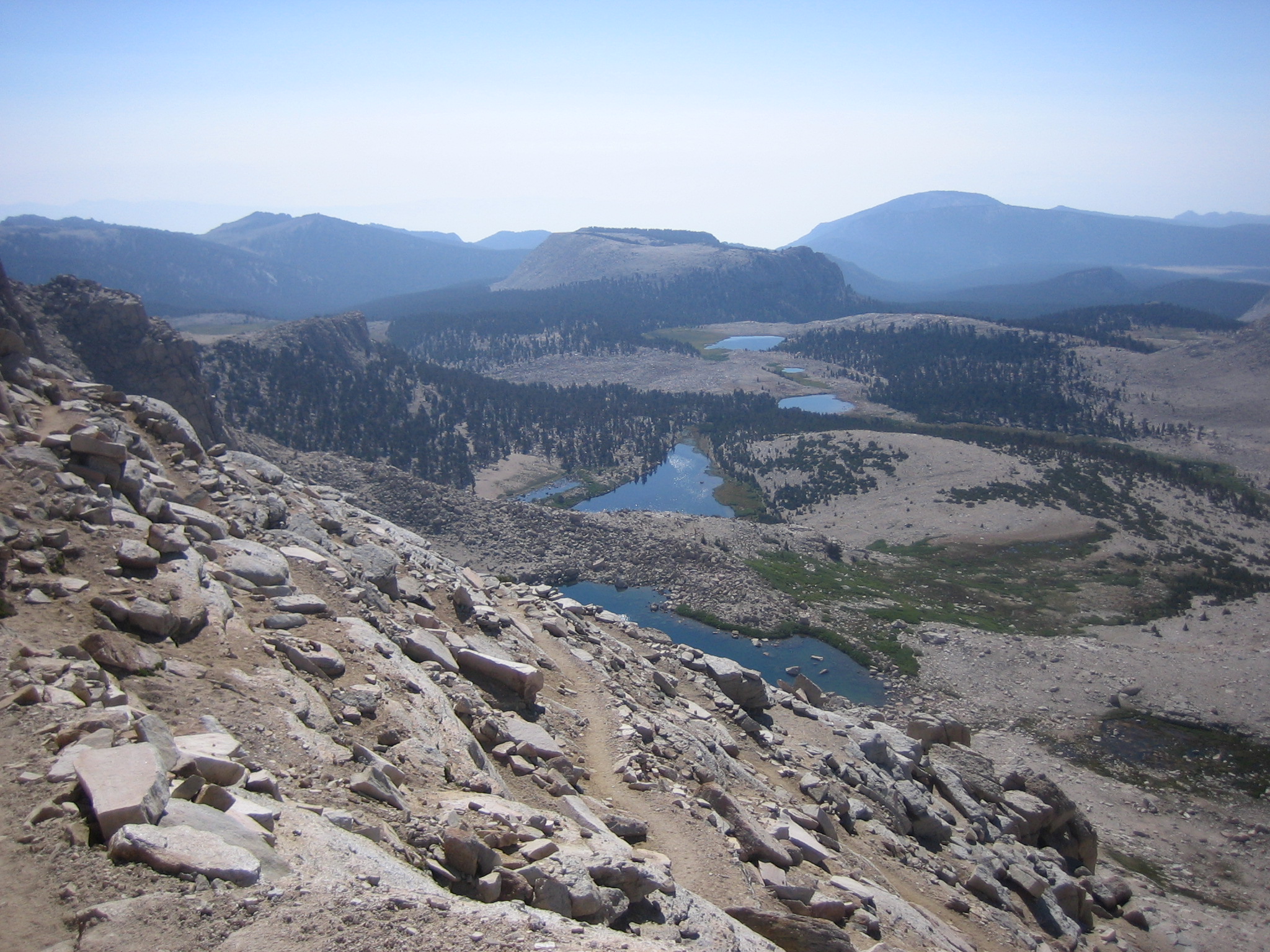
At this point we were .75 mile from the Bishop Pass and decided we were both too tired to do the pass and get back without risk. We were at 11,400 feet and had done 1600 feet elevation gain above 10,000. Maybe next year when I'm 80. If you believe that I have a few things you may be interested in buying. The round trip was 6.5 hours and 9.5 miles.


Lake Sabrina Basin


Getting on an iceberg   photo John Knadle (click to enlarge, x to get back)


Surfing an iceberg   photo John Knadle

Sorry for the click bait, but I've got to get your attention somehow. This was taken many years ago, when whitie tighties were standard multipurpose shorts and the author had black hair and beard. Those days are gone, but I would like to recount a recent trip to the Sabrina Basin which kindled old memories. But first, please let me set the context for this most recent trip. 

I have always loved the big lake approach to backpacking in the Sierra. You start high, but have the fisher folk and merchants to thank for paved, plowed roads leading to adequate parking at high elevations. For me, the Sierra is at it's most pristine and wild above 10,000 ft. The above pictures were taken above 11,000 feet at Echo Lake, one of the highest in the basin. 

My favorite lake in the Blue Lake and up drainage is Midnight Lake. It's stark beauty makes for deep thoughts and access cross-country to other higher lakes. I picked it to dazzle my wife Kathy when we were first dating. As you can see from the map, there is a lot of territory between Blue Lake (our objective on Tuesday 9/5) and Midnight Lake. This made for a long first day and stressed the mating ritual, but Kathy hung in there and we had a great time overall. Never fear, the details of the recent Sabrina to Blue Lake will be explained in detail that the map doesn't cover.


Echo Lake on bottom Midnight left of red line near center


Kathy and I celebrating our 25th at Midnight Lake

So, now that I have given a little history of this basin, let's get back to this week's adventures. As any of you who have reached the age of reason, let's say 60, what you could do in the past only becomes relevant at high school reunions or after too much alcohol. I am pushing 80 and Kathy is 15 years younger. Some of my previous behaviors probably could not pass muster in today's world. 

We get to the parking lot at Sabrina at 8:30. It is 36 degrees and Kathy has a very small daypack without gloves or hat. One of her pet peeves is that I monkey around too much getting ready. So, she says " I'm going". From the looks of the ridge we are following, we will not see the sun for an hour or more. This drainage is supposed to be a warm up for Bishop Pass, tomorrow's goal and things are looking bad. 


The Lake is full and there is a great view from the trail

I still can't seem to get my rhythm in order to make good time. Then I remember the breath step. It is inhale through the nose on one step, exhale with pursed lips to two or three steps. The emphasis on the exhalation gets the bottom of the lung clear and allows gravity to fill it. 

So, I'm starting to make better time and there is hope for tomorrow.


Blue Lake looking towards Echo Lake in far distance

So, we take a 15 minute lunch break and head back to the trailhead.


Should have brought the Crocs, which work great 


Sabrina, looking toward the Whites

So, the stats were 3 hours to Blue Lake and 2.5 hours back to trailhead. I will publish another blog on the South Lake to Bishop Pass done on Tuesday 9/6.


Back to our campsite at 4 Jeffries

Tuesday, March 21, 2023

Sears Point


      Carrizo Overlook from our campsite looking north

We wanted to get an early start on the Sears petroglyph site, so Carrizo Overlook was an easy choice. The ground flowers were everywhere, so we enjoyed them while having coffee, before getting back on highway 8 towards Yuma.


The traffic wasn't bad on the 80 miles to Yuma. After a fuel stop, we took about half an hour to get to the turnoff for Spot Road. Our plan was to go about 5 miles in and find some decent place to camp, just before the washboarded road runs into the sand washes that were once the Gila River. We had e-bikes with 2.3 inch tires to do the remaining 2 or 3 miles to the Sears Petroglyph site. We camped on a solid desert pavement flat spot, across from some off road types with a generator and toys. Plenty of room for everyone and they were friendly. It was a little windy, but not to the point of blowing sand yet. We unloaded the bikes and got going.


Kathy heading out on road that was a little sandy in sections

(click to enlarge, x to get back)

The views were expansive and the horizon seemed endless. Once we got to the sandy sections, Kathy's and my riding styles became somewhat different. Her philosophy was to go to level 5 (the max) pedal assist and go fast enough to stay on top of the sand as long as no mistakes or whims of fate took her by surprise. My approach was to use level 3 and struggle a bit more with the front end taking off this was or the other. She had a big smile whenever I would catch up. 


Saguaro Cactus

We got to a few muddy parts and had some question about our intended goal, but made it to the signed site without too much trouble. Locked the bikes together behind some trees and proceeded to the info boards. We had seen no  one to this point, and everything was open dirt except for some marginal fences to keep OHV out.


The surrounding area was mostly volcanic large rock boulders with perhaps 300 feet of elevation from the desert floor. I could see that there was at least a mile of similar terrain towards the west. The area had faint trails that I am sure had nothing to do with indigenous occupation. We took one and were quickly rewarded with some petroglyphs.


My go to authority on rock art is Don Liponi, a San Diego native who was the main author of "La Rumorosa Rock Art Along the Border", although many other subject matter experts are quoted therein. He is a true friend of the Kumeyaay tribes and has helped provide the members with avenues toward recognition and education. 

He says " Sears Point is the eastern frontier of Patayan landscape when it meets Honokam culture." Lowland Yuman, such as Quechan, Mohave, Maricopa, Kumeyaay, Cocopah etc. are historic descendants of the Patayan. The Hohokam were the pit dwelling archaic base east of  Sears Point (see my post before this one). Lipponi says of the the Sears Point rock art "here we have some familiar Patayan or Yuman elements such as multiple sunbursts, rectangular grids, geometric forms including some possibly stylized snake representations, centipedes and perhaps some anthropomorphs."


Kathy with welcome sign (it is also on the art to her left)

One of the best rock art sites that I have visited. We saw no other people on this visit, but heard some OHV stuff  beyond the site. This is a very unusual place of peace and time. 

Monday, December 13, 2021

Painted Rock and Three Rivers Petroglyph Sites

       Three Rivers New Mexico and Painted Rock in Arizona


                        (click to enlarge, x to get back)

We actually drove the 5 hours from SD to Painted Rock first, but thought I'd better lead with my best picture. This beautiful lady looks back at you from 600 years ago at the Three Rivers Petroglyph site in New Mexico. There is a cool thing about basaltic rocks (from an upheaving volcano) and their life in the desert. They take on a "desert varnish" from weathering and provide a great canvas for someone with artistic talent and a stone or two.  As you pick at the rock, it becomes a canvas. The Three Rivers art is realistic, in contrast to the San Francisco or La Rumorosa style.  The spiritual journeys of the medicine men in Baja and San Diego were carried out in remote, dark, lonely spots best frequented by snakes and other vermin. The sites I am about to describe are a more social and less introspective variety. Painted Rock in particular is "more Facebook" as my better half noted.

We get to the Painted Rock turnoff by exiting Highway 8 on a road by the same name. We are a little road dazed, but manage to fill out the BLM fee envelope and get  spot close to the rock mound that is the centerpiece to the the campground. We are happy to be somewhere and start unpacking the bikes and other gear we will be using. We have 10 days, so no big rush. It is a typical BLM campground with vault toilets, big trash cans and paths around the central pile of rocks with more petroglyphs (scratch the desert pavement not paint) than I have ever seen anywhere.

I am pretty stoked about the Gila River thing. It was the way the early pioneers went westward without dying in larger numbers. The Gila was the basis for the Great Southern Route to the resort city of San Diego. It had shade, potable water, and animals to sacrifice for the good of westward expansion. The next day we took off on our Rad City e-bikes to explore the Gila River and pioneer history. Unfortunately, the road to the Gila River Dam terminates about 300 yards from the earthen dam. Darn, Homeland Security wins again over any attempt to see  water in the Gila River. No Trespassing! We go back toward the campground and go west by the corporate alfalfa fields, waving at the operators of $100 K tractors. At the end of the fields on the south side there are 6 javelina (Pecarry) taking it to the man by eating the highly green alfalfa a la carte. They jump around at our excitement and seem more like teddy bears than aggressive wild boar.

                       Javelina tracks on farm road

So, I didn't get any pictures of the peccary.  I only had an iPhone, not my weapon of choice, the Panasonic sx60 with a bigger telephoto lens. Three subsequent trips to the same field yielded zip on the same subject.

So, let's talk a bit on the pictographs at Painted Rock. They date from 7,000 BC and contain the archaic style (mostly geometric patterns) to the Gila Style with human forms and anthropomorphic images  with other parts added. Don Lipponi, who wrote "La Rumorosa Rock Art Along the Border" recommended an iPhone app "iDstretch", which helps to bring out faint pictograph or pictoglyph images. For me, it is kind of a poor man's Photoshop ($6).

           This is a mix of the archaic and Gila styles

The thing about the Painted Rock site is that it has art from the earliest markings (7000 BC) and those that are in the Hohokam occupation from 50 BC on. The first artists were desert survivors who gathered plants and had occasional meat. At about 9000 BC, the large animals such as elephants, bison, horses etc. died out from climate change not caused by petrol dependency. Anything that looks vaguely like a human is not the archaic period, think ladders and geometric designs.

The e-bikes gave us a break from the tourists going around the big rock pile that is Painted Rock. We kept trying to catch the pesky pecarrys, but to no avail. The major volcanic mountain toward the west is Oatman Peak. We braved the washboard and uncertainty for ten miles or so out into the volcanic desert pavement and traded power levels for the lead in this endeavor. It was a pounding ride without rear suspension, but you use what you have. 

                      At the right end of the road is camp


                             Beauty in the Lava

We spent 4 days at Painted Rock to a mostly deserted BLM campground. Though we were there in early December, it was the warmest part of the trip with big starry skies. The next stop was a short hop to Lordsburg, New Mexico for a shower and Subway. Got to Three Rivers Petroglyph site in late afternoon the next day and scored a BLM with electricity to run our little 1500 watt space heater. Life is good.

      Three Rivers Petroglyph Site, NM near White Sands

The area where archaic pit houses and more permanent pit houses were located.


Archaic Period Pit House

As you can see the pit house style of home ownership is pretty basic. You put some twigs, mud over the top and have a small hole in the middle to let the smoke escape. The Mogollon culture in the early period were hunter gatherers who moved through the southwest as opportunity presented itself. The village site is to the east of the hills that contain the petroglyphs. They were originally a mountain people, tough and resourceful. Their art style is often quite realistic, as can be seen from the lead photograph. As farming became another source of food, the hunting and gathering still made them more independent than other groups that relied on river flooding exclusively. After crossing about 10 signed rivers with no water running (unless you count the New River, which is really disgusting), I think our infatuation with dams has reached a logical conclusion.

Many of the petroglyph have patterns within the main figure.


The mountain sheep were a prey that was highly prized.

There are over 20,000 petroglyphs at the Three Rivers site. I chose it from a book titled "Rock Art Along the Way" by Janet Farnsworth. She gives a thumbnail descriptions of sites you can visit in the southwestern states. A more formal description of current knowledge and best guesses of the experts is "The Archaeology of Ancient Arizona" by Reid and Whittlesey. If you want to get down in the weeds on pit houses and current Gila River archaeology, try:


    Assorted Pictograph Pictures


Friday, August 28, 2020

4 Nights and 5 Days over Cottonwood Pass with my brother Marty

 I hadn't been backpacking since going with my brother a few years ago, so was happy to join him in another Sierra adventure a few weeks ago. Our trip started at Cottonwood Pass and the last night I took this picture of my tent at 11,000 foot elevation as the moon was setting.

Click on any picture to enlarge. Click on upper right x to return to text

We had originally planned to exit at Kearsarge Pass, but changed our itinerary when the Onion Valley hiker parking lot was more crowded than either of us had ever seen. We decided to learn more about this area that is a little south of Whitney. I have identified each camp we made while doing the Cottonwood to New Army Pass loop on the map below.

The last camp is south of the marked location, near Long Lake

We left the truck at 4 pm and got over Cottonwood Pass just before dark. A helo had been circling around the pass for about 20 minute and was at Chicken Spring Lake at dark when we arrived there. It was a very tight takeoff, with bright lights flashing and very noisy. A young woman had altitude sickness or a diabetic episode and her father called in the rescue. It was probably very expensive but a good decision.

Helo takeoff

When Marty did the PCT in 1979, the route from Kennedy Meadows followed the flat contour of many giant meadows that led to Siberian Pass and then joined the current PCT route. We did a day hike from our second camp below Major General Mountain to the Siberian Pass for old times sake. It is not used any more to preserve the fragile meadows.  Marty did a 17 day long slog without reprovision in snowy weather and deep snow, exiting at Kearsarge Pass. I remembered that a with a friend we had attempted delivering the resupply with some search and rescue assistance. We didn't make it over Kearsarge Pass in avalanching conditions, but that's another story.

Marty near Siberian Pass

The meadow in front of our camp below Major General Mountain was pristine and very wet. There were many marmots and no other campsites could be seen. We stayed at a large, flat camp with great views and easy water access.


We got an early start on New Army Pass to avoid the heat and accomplish the 2000 foot elevation gain with the rising sun. We had the pass to ourselves until almost at the top.

Marty starting up the steep portion of New Army Pass

Great view of the south side of New Army Pass

The New Army Pass is quite a perch. It's south aspect is nearly vertical and is a tribute to the trail builders non existent fear of heights. The second lake in the chain was the site of our last camp. It was a perfect night for gazing at the stars and reflecting our good luck to live in such a beautiful world. God bless whoever saved this wilderness for the future.


Backstory:

The last time I had backpacked was about two years ago. Kathy, Marty and I did about 70 miles on the John Muir Trail. By the end of the backpack, I was peeing blood and my fingers had started cramping up from all the stuffing, putting the tent up and down, and getting in  and out of the bear canister. The way my fingers would freeze up in odd positions was quite comical, but kind of a show stopper. Kathy started doing a lot of the work to help me out, so I knew that a few senior adaptive techniques were in order to make me more self sufficient. 

First, rather than use the small bags and cramming the sleeping bag or tent into them, I used some winter stuff bags that have straps that use buckles to cinch down the load. Second, bought a small pair of pliers to deal with the velcro tabs in my self supporting Black Diamond Bibler tent and the straps on the stuff sacks.

Dehydration was probably the source of the pee problem on the last backpack. For some reason, I don't drink well on the move. On this trip I got the idea to wake early and drink a quart before getting out of the tent. This saved the water weight in the pack and seemed to work much better at keeping me hydrated. 

A person younger than 76 probably wouldn't have any trouble using a quarter to turn the three screws in my Kevlar bear canister that make it bear proof. After this trip, I now have a small slot screwdriver in my side pocket to accomplish this frequent task easily!